
Parco degli Acquedotti
20 min bike ride
This public park preserves impressive sections of the Aqua Claudia and Anio Novus aqueducts, serving as a functional contrast to the underground catacombs.
Rome's aqueduct system spans eleven separate channels built between 312 BC and 226 AD, delivering water from mountain springs as far as 92 kilometers away. The most accessible ruins stand along the Via Appia Antica corridor and within Parco degli Acquedotti, where monumental arches still cross open countryside. This guide maps the visible sections and explains how to reach them from central Rome and the Catacombs of Rome.
Quick answer
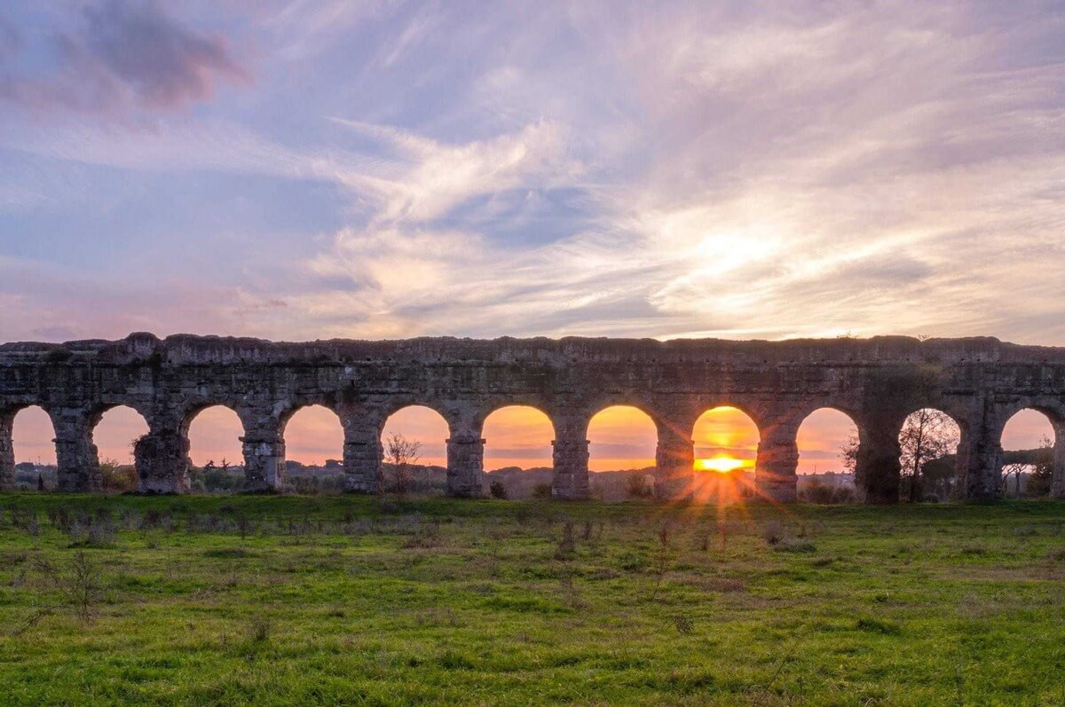
The most prominent Roman aqueduct ruins are located in Parco degli Acquedotti, southeast Rome, where the Aqua Claudia and Aqua Felice aqueducts form dramatic double-tiered arches across seven hectares of parkland. Along Via Appia Antica near the Catacombs of Rome, visible sections of the Aqua Marcia and Aqua Claudia run parallel to the ancient road. Other fragments appear in scattered locations including Porta Maggiore, the Trevi district foundations, and suburban neighborhoods where developers preserved arcade segments as public monuments.
Where are the roman aqueducts located becomes a question with eleven answers, because Rome sustained eleven separate channels, each following its own contour from distant springs to city distribution points. The Aqua Appia, the oldest, ran entirely underground from springs eight miles east; the Aqua Claudia, the tallest, crossed valleys on arches reaching 27 meters. By the second century AD, these conduits delivered over one million cubic meters of water daily to baths, fountains, and private households across a city of more than a million inhabitants. The southeast corridor holds the densest concentration of standing ruins. Parco degli Acquedotti preserves the most photographed stretch: two parallel arcades, the lower belonging to Aqua Claudia (completed 52 AD) and the upper to Aqua Felice (1586 AD, reusing ancient foundations), marching across open fields between Via Lemonia and Vicolo del Mandrione. The park lies three kilometers from the Catacombs of Rome along Via Appia Antica; a direct cycle route connects them without retracing roads. North of the park, Porta Maggiore displays the junction where six aqueducts converged before entering the city walls. The Aqua Claudia and Anio Novus crossed above the gate, their channels still visible in the masonry. Nearby, Aqua Marcia fragments surface in residential courtyards and Metro construction sites, testimony to the network's sprawl beneath modern neighborhoods. West along the Appian Way, aqueduct arches punctuate the roadside between the second and sixth mile markers. These segments carried branches feeding suburban villas and rural farms. The Via Appia Antica Regional Park manages access to several stretches where visitors walk beneath intact arcade spans, inspecting the opus reticulatum brickwork and hydraulic concrete that sealed the channels. Locating Rome's aqueduct remains requires distinguishing original construction from Renaissance and Baroque reuse. The Acqua Felice, commissioned by Pope Sixtus V, deliberately shadowed the ancient Aqua Claudia route, and restorers often rebuilt atop Roman foundations. Modern maps label both eras, but field inspection reveals the shift from travertine and tufa blocks to Renaissance brick facing. The aqueduct network location reflects Roman engineering ambition: every source, every arch, every distribution castellum positioned to harness gravity across a metropolitan scale unmatched until the nineteenth century.
“The Aqua Claudia crossed valleys on arches reaching 27 meters, a monument to engineering ambition sustained across four centuries of construction.”
The Catacombs of Rome are located directly on the Via Appia Antica, a historic route that provides direct access to the surrounding archaeological park where major Roman aqueduct remnants are situated. Visitors typically reach the site via public bus or bicycle from the city center.
Line 118 from Colosseo to Appia Antica/Catacombe
Line A to Colli Albani then bus 664
Via Appia Antica (from Porta San Sebastiano)
Cycling remains the most effective way to transition from the Catacombs to the nearby Park of the Aqueducts. For the most efficient start to your day, plan your arrival at the entrance on Via Appia Antica, 110-136 during the early morning hours.
The Appian Way offers a concentrated area of ancient engineering and funerary history. Combining your visit to the catacombs with the nearby aqueduct park provides a complete overview of Roman hydraulic and burial infrastructure.
20 min bike ride
This public park preserves impressive sections of the Aqua Claudia and Anio Novus aqueducts, serving as a functional contrast to the underground catacombs.
5 min walk
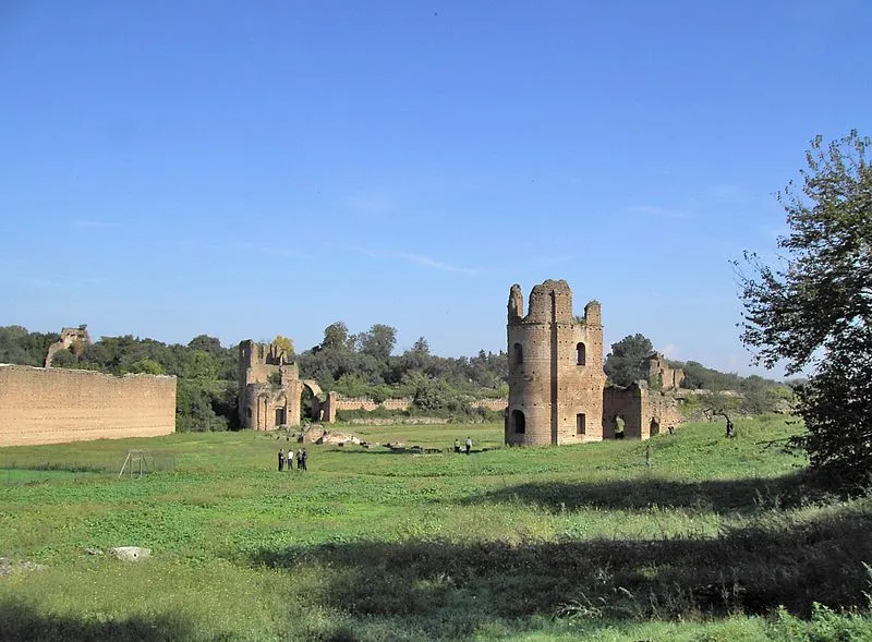
Located just down the road from the catacombs, this site offers a well-preserved look at a Roman chariot racing venue from the 4th century.
2 min walk
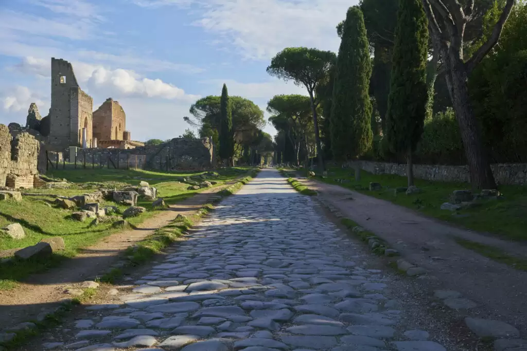
The road leading to the catacombs is lined with ancient funerary monuments that provide context for the historical significance of the Appian Way.
The Catacombs of Saint Callixtus are open daily to visitors throughout the week.
Everything you need to know about where are the roman aqueducts located
The Catacombs of Rome are situated along the Appian Way, a historic road where are the Roman aqueducts located nearby within the surrounding Parco Regionale dell'Appia Antica. While the subterranean galleries focus on burial chambers, the adjacent park offers views of the iconic stone arches.
Yes, many visitors choose to explore the engineering history of the city by bicycle. This allows you to traverse the landscape where are the Roman aqueducts located and observe the massive volcanic rock structures.
Combining a visit to the underground chambers with a cycling tour of the Appian Way provides a comprehensive overview of Roman infrastructure. This allows you to easily reach remote points where are the Roman aqueducts located that are often missed by foot traffic.
The structures are primarily found throughout the Parco Regionale dell'Appia Antica, which spans the area around the Catacombs. You can access these historic sites by following the ancient path of the road.
The standard admission fee is 10 EUR per person. Please note that this fee covers the guided tour of the underground site.
The site is open daily from 09:15 to 17:15. This schedule applies throughout the week including weekends.
The best arrival window is between 09:15 and 10:30. Arriving early helps you avoid peak crowds and large tour groups.